Saturday, November 27, 2010

Day 65-66


from Sapelo Island to St. Simons Island, GA
N 31 09.741 W -81 25.191
28 miles, 4 hours


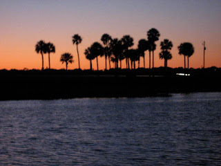
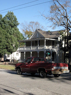
It's difficult to post pictures with the connection here,  so these are the high points of St. Simons:


-small airport right on the main road, where you can watch the takeoffs and landings of locals with their own planes
-quirky used bookstore
-great barbecue place
-municipal landscaping:  the entire island is groomed.
Elle says Sea Island- the ocean side- even dictates the color of flowers you're allowed to plant- sorry to miss that!

Wednesday, November 24, 2010

Day 62-64

Murals in the Circus Room at RJ Reynolds' mansion-


from Ossabaw Island to Sapelo Island, GA
N 31 26.391 W -81 17.537
32 miles, 5 hours


We're stuck here in the Georgia sea islands- too beautiful to leave.  We think we'll stay at Cumberland Island for a few days- that's the last one- and then head out along Florida to Key West.  Today we join a tour of Sapelo Island, as that is the only way to visit.  There are some residents grandfathered in here, but no tourists.  Most of it is saltmarsh.  A lot of these islands are off limits to the (human) public, which makes them all the more beautiful.


The tour took us to the only town on the island, Hog Hammock.  People still living here full time (about 50) are descended from slaves.  Kids take the ferry to school in Darien, and the people left here are mostly older ones.  They work for the state of Georgia and rent out rooms to tourists.


Sapelo was owned by a series of tycoons, the last of whom was R.J. Reynolds.  We roamed around his mansion, which you can rent out for house parties- many bedrooms.  Fabulous decor, last updated in the 50's.


On Thansgiving morning, one of the local kids took us around on a private tour.  So we saw historic buildings/ ruins, beaches, and favorite hunting spots.  These guys love to hunt!  Here they have wild cows, raccoons, possum, and the occasional coyote.  All were on the menu at his grandma's that day, except the coyote.  When we said we were having lamb, he was really interested- 'Yeah? what's that taste like?'


Sunday, November 21, 2010

Day 59-61


Moon River to Ossabaw Island, GA
N 31 45.824 W -81 08.739
20 miles, 3 hours
Ossabaw is one of the Sea Islands, a large one.  It seems to be inhabited by wild birds, deer, and pigs, and is absolutely beautiful.

We went ashore again this morning intending to take pictures of all the fun stuff we saw roaming around yesterday, but all we saw were a tribe of black pigs fleeing into the underbrush- little ones- they looked like Scotties.

Friday, November 19, 2010

Day 58


Beaufort, SC to Moon River, GA
N 31 55.524 W -81 04.459
50 miles, 8 hours

Day 56-57


Beaufort, SC
We had to stay here a couple of days eating barbecue to get over the trauma of anchoring.  Also mesmerized by the marina owner at Factory Creek, who spent ten years on his sailboat roaming around the Caribbean.

Tuesday, November 16, 2010

Day 55

from Dawho River to Beaufort, SC
N 32 25.424  W -80 39.956
32 miles, 5 hours


We were stuck in the mud here for an hour and a half today, and I feel I know every grass tuft personally.  The plan was to anchor well away from other boats, but we got mired in mud. and the wind kept blowing us up onto the shore.  Lorenzo finally worked the boat out.  The usual thanks to all Muzz's favorite saints who were pressed into duty.

Day 54

from Marks Bay to Dawho River, SC
N 32 3.148  W -80 19.831
43 miles, 7 hours

Monday, November 15, 2010

Day 53


from Georgetown to Marks Bay, SC
N 32 53.478  W -79 41.861
39 miles, 6 hours
Anchored last night in the salt marshes.  Deluxe place.  Swam in salt water!  Had Verizon reception!  This is just north of Charleston, so today we'll pass through there and see what's on the other side.

Saturday, November 13, 2010

Day 52


from Waccamaw River to Georgetown, SC
N 33 21.530  W -79 16.872
25 miles, 4 hours
A town with groceries!  we bought:  lettuce, collards, cabbage, potatoes, onions, apples, and tangerines.

Day 51


 We decided to stay another day in the swamp- it really was lovely there.  Colors were very different, and light was low.  We took the dinghy up an endless river.  Very few people around, but a couple of boats stopped to anchor at night.


Thursday, November 11, 2010

Day 50


from Bowen Point, NC to Waccamaw River, SC
N 33 39.960  W -79 04.197
40 miles, 6.5 hours
We're anchored in a lovely swamp.  

Day 49


from Carolina Beach to Bowen Point, NC
N 33 54.831  W -78 22.278
31 miles, 5 hours
Wetlands, fishermen, condos.

Tuesday, November 9, 2010

Day 48


from Topsail Sound to Carolina Beach, NC
N 34 03.127  W -77 53.265
27 miles, 5.5 hours

We're in line behind three sailboats at this bridge, one of two today.  The ICW is very slow.  On the upside, you see things like this:


Monday, November 8, 2010

Day 47


from Bogue Sound to Topsail Sound, NC
N 34 24.479  W -77 35.658
42 miles, 7.5 hours
Not the typical house along the ICW, but certainly a standout.

Sunday, November 7, 2010

Day 45-46


Saturday  11/6
from Beaufort to Cape Lookout, NC
N 34 37.214  W -76 32.948
11 miles, 2 hours


Sunday  11/7
from Cape Lookout to Bogue Sound, NC
N 34 43.227 W -76 53.794
21 miles, 3.5 hours

This is the harbor outside Beaufort- we wouldn't fit inside easily.  As it was, our anchor dragged, and we added another 100 feet of chain to it- that seems to have done the trick.  Saturday we came down to Cape Lookout, a beautiful beach- BUT COLD!  The wetsuit thing is good, though- water seems warmer than the air.  Credit to the Felix the catamaran for the pix.


Saturday, November 6, 2010

Day 41-44


Beaufort, NC


where's this guy going?  we're thinking one of the fishermen got sick of sitting out there in the cold, and sent for some home comforts.  still not sure what they're fishing for- flounder, bass, trout are all abundant.  They're out there in all sorts of weather- in open boats- in waders, even.

Monday, November 1, 2010

Day 40

from Cedar Creek to Beaufort, NC
N 34 42.886  W -76 40.567
16 miles, 2 hours


what 1960's car does this remind you of?

Day 39

from Belhaven to Cedar Creek, NC
N 34 55.968  W -76 38.961
46 miles, 7.5 hours